
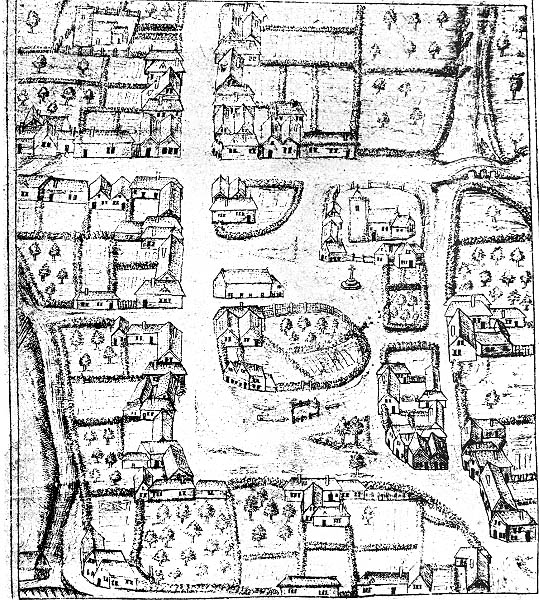
Wilton from a drawing of c.1568
- Date of image
- Date uploaded
- 25 October 2007
- Number of views
- 844
- Number of comments
- 0
- Location of image
- Wiltshire & Swindon History Centre, Chippenham
- Notes
-
A very rare early town centre map from the Survey of the Lands of William, First Earl of Pembroke. The drawing shows the Market Place, with St. Mary's Church and the market cross in the top right corner, and the cross roads, known as Four Corners in the top left corner. Most of the twelve medieval churches and many medieval houses have already gone.