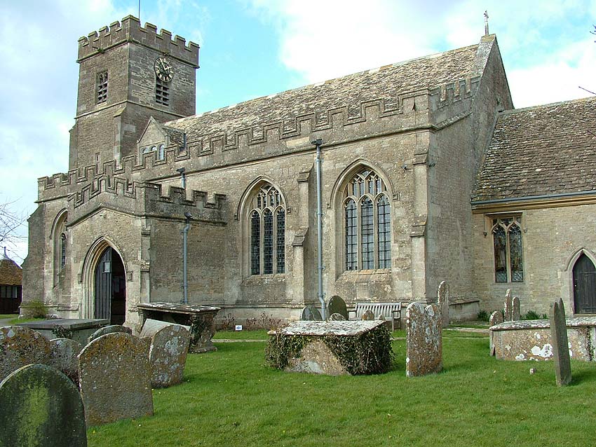
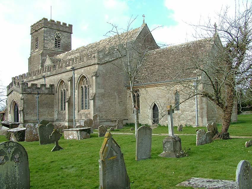
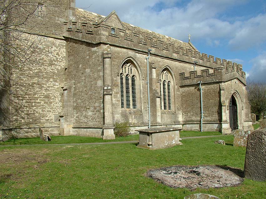
The civil parish of Brinkworth is one of the largest in Wiltshire Within the parish lies the village of Brinkworth itself which runs some 4.2 miles along the B4042 main road between Wootton Bassett and Malmesbury and is reputed to be the longest village in the country.Also in the parish are the hamlet of Grittenham and other scattered settlements and farmsteads. The parish formed two tithings: Brinkworth to the north and Grittenham to the south. Brinkworth and Grittenham tithings lay within Startley Hundred until 1226 when Malmesbury Hundred was created. The name \"Brinkworth\" itself is believed to derive from the Old English \"Brynca's farmstead\"; the name \"Grittenham\" may mean \"gravelly enclosure\".
No Saxon remains have been discovered in the parish but two discoveries of earlier Roman artefacts have been located.In 1908 four coins of considerable rarity were found in a field near Longman's Street Farm and these are now held in theAshmoleanMuseum,Oxford.In 1986 a quantity of ceramics was discovered in the same area and it is believed that a Roman kiln producing flagons and tiles from the local clay existed here from approximately AD 70 to AD 130
The boundaries of the parish - the shape of which has been noted as similar to that of the African continent - are marked largely by roads and watercourses. There are outcrops of Oxford clay over the whole of the parish except where a small area in the south-east features sand, silt and clay of theLower Corallian outcrop. Elsewhere, Brinkworth,Woodbridge and Lilly brooks have all laid down alluvium deposits. The parish as a whole drains westwards to the BristolAvon and is crossed by ridges and valleys running from east to west. Brinkworth brook flows across the centre of the parish but in the eastern section where it divides the former Brinkworth and Grittenham tithings, it becomes Grittenham brook. Further north,Woodbridge brook flows across the whole of the parish.
The land is highest, at 130 metres, in the south-east of the parish but this height is closely followed by land in the north-east and north-west where it is in excess of 120 metres. Sundays Hill, Ramps Hill and Callow Hill are all located in the north of the parish and are over 110 metres.
Between the years 1300 and 1630, parts of BraydonForest totalling some 1250 acres were included within Brinkworth parish and in 1884 other parts of the forest, which had been allotted to Milbourne in Malmesbury and to Little Somerford, totalling some 309 acres, were also included within the parish. In the same year, 1884, a detached part of Dauntsey parish comprising 42 acres was transferred to Brinkworth and, between 1891 and 1901 a total of 16 acres were transferred from Dauntsey and Lyneham.From 1901 onwards, Brinkworth parish contained 6075 acres.
<
b
r
/
>
<
p
>
<
s
p
a
n
s
t
y
l
e
=
\
"
f
o
n
t
-
f
a
m
i
l
y
:
T
i
m
e
s
N
e
w
R
o
m
a
n
;
\
"
>
<
s
p
a
n
s
t
y
l
e
=
\
"
f
o
n
t
-
s
i
z
e
:
m
e
d
i
u
m
;
\
"
>
B
y
1
1
3
5
<
/
s
p
a
n
>
<
s
p
a
n
s
t
y
l
e
=
\
"
f
o
n
t
-
s
i
z
e
:
m
e
d
i
u
m
;
\
"
>
B
r
a
y
d
o
n
<
/
s
p
a
n
>
<
s
p
a
n
s
t
y
l
e
=
\
"
f
o
n
t
-
s
i
z
e
:
m
e
d
i
u
m
;
\
"
>
F
o
r
e
s
t
<
/
s
p
a
n
>
<
s
p
a
n
s
t
y
l
e
=
\
"
f
o
n
t
-
s
i
z
e
:
m
e
d
i
u
m
;
\
"
>
w
a
s
a
r
o
y
a
l
f
o
r
e
s
t
f
o
r
h
u
n
t
i
n
g
a
n
d
c
o
v
e
r
e
d
a
n
a
r
e
a
o
f
a
p
p
r
o
x
i
m
a
t
e
l
y
4
6
s
q
u
a
r
e
m
i
l
e
s
.
<
/
s
p
a
n
>
<
s
p
a
n
s
t
y
l
e
=
\
"
m
s
o
-
s
p
a
c
e
r
u
n
:
y
e
s
;
\
"
>
<
s
p
a
n
s
t
y
l
e
=
\
"
f
o
n
t
-
s
i
z
e
:
m
e
d
i
u
m
;
\
"
>
&
n
b
s
p
;
<
/
s
p
a
n
>
<
/
s
p
a
n
>
<
s
p
a
n
s
t
y
l
e
=
\
"
f
o
n
t
-
s
i
z
e
:
m
e
d
i
u
m
;
\
"
>
B
e
t
w
e
e
n
1
3
0
0
a
n
d
1
6
3
0
t
h
e
a
r
e
a
o
f
t
h
e
f
o
r
e
s
t
w
a
s
g
r
e
a
t
l
y
r
e
d
u
c
e
d
a
n
d
i
n
t
h
e
l
a
t
t
e
r
y
e
a
r
t
h
e
<
/
s
p
a
n
> Forest was enclosed and the Court of the Exchequer cancelled all common rights there.The purlieus of the forest were enclosed shortly afterwards.The north and western section of Brinkworth tithing's part of the purlieus, totalling some 1,000 acres, remained with the lord of the manor and these were subsequently converted into farmland.The smaller sections to the east and south-east, totalling some 250 acres, became common land for the tenants and copyholders of Brinkworth manor.Smaller common pastures remained at locations in the north of the parish including Barnes Green, Clitchbury Green, Giles Green, Dollakers Green, Hulberts Green and Sundays Hill.Brinkworth Common, formerly forest purlieus, was enclosed in 1808.
The Swindon to Malmesbury road crossing the parish from east to west on high ground was turnpiked in 1809 and disturnpiked in 1876. In the later 20th century a section of the M4 London toSouth Wales motorway was constructed to the south of the Swindon-Malmesbury road; this section of the motorway was opened in 1971 and resulted in some changes to the routes of pre-existing lanes.
Other, earlier, transport developments took place in Brinkworth parish when the Wilts. & Berks. Canal was constructed across the southern tip of the parish and opened c.1801. On the Brinkworth/Lyneham parish boundary Tockenham reservoir was created to feed the canal. The canal was closed in 1914 but in the late 20th and early 21st centuries volunteers with the Wilts. & Berks. Canal Partnership are carrying out its restoration.
In 1841 the GWR London to Bristol line was opened north of the canal, also in the southern tip of the parish. The London-Bristol line branched at Wootton Bassett from 1903 onwards to provide a more direct route toSouth Wales. The more northerly line crossed the parish to the south of Brinkworth village where a station, stationmaster's house and associated cottages were built; the station closed in 1961.
It has been suggested that Brinkworth village itself, sited on a ridge between Brinkworth Brook and Woodbridge Brook along the Swindon to Malmesbury road, is of Romano-British origin.In the Andrews and Dury map of 1773 the village is as yet quite compact but with a number of small outlying settlements, at Clitchbury Green, Giles Green, Causeway End, Dollakers Green,Woodbridge (later Hulberts) Green, Barnes Green and Box Bush.Since that date the village has spread westwards and eastwards along the road and a settlement has developed around Callow Hill on Brinkworth Common.
In 1086 the Domesday survey recorded that an estate of 5 hides (approximately 600 acres) at 'Brecheorde' was held in 1066 by Malmesbury Abbey which claimed that it had been the gift of a nobleman named Leofsige. At this stage one hide, with two plough-teams and eight people, was in demesne.
T
h
e
r
e
w
e
r
e
1
2
a
c
r
e
s
o
f
m
e
a
d
o
w
a
n
d
w
o
o
d
l
a
n
d
2
f
u
r
l
o
n
g
s
l
o
n
g
a
n
d
1
f
u
r
l
o
n
g
w
i
d
e
.
<
/
s
p
a
n
>
<
s
p
a
n
s
t
y
l
e
=
\
"
m
s
o
-
s
p
a
c
e
r
u
n
:
y
e
s
;
\
"
>
&
n
b
s
p
;
<
/
s
p
a
n
>
<
s
p
a
n
s
t
y
l
e
=
\
"
font-size: medium;\">The land was worth £4. A knight held c.120 acres of this land and these were worth 15 shillings. The 5 hide estate subsequently became Brinkworth manor and continued to be held by Malmesbury Abbey until the Dissolution. In 1544 the manor was granted to William Stumpe; it descended to his son Sir James Stumpe and then to the latter's daughter Elizabeth whose own daughter Catherine married Thomas Howard, created first earl of Suffolk in 1603.The manor then passed to his son, Thomas Howard, earl ofBerkshire who died in 1669. The manor subsequently descended with the earldom of Berkshire and, from 1745, with the earldom ofSuffolk. In 1840 Thomas Howard, earl of Suffolk and of Berkshire, owned some 1793 acres in Brinkworth parish; Thomas's son Charles subsequently sold some 10 farms comprising 1,117 acres in 1858, leaving a remainder of holdings in the north west of the parish which passed to Michael Howard, earl of Suffolk and Berkshire. The family lived at Charlton Park House. In 1960 this land was sold to Southery Farms Ltd.
and between 1963 and 1967 this company sold the land in the form of three farms.
The Domesday Book records another 5 hide estate at Brinkworth named 'Brenchewrde' which had land for three ploughs, 24 acres of meadow and 3 acres of pasture; woodland 4 furlongs long and 4 wide. This would also become part of Brinkworth manor.In 1066 it was held by an individual named Tochi and in 1086 by Miles Crispin whose tenant was Humfrey. Four hides and land for one plough were in demesne. This estate was located in the west of the parish and it is believed that by the later 13th century some five parts of it were held separately. Of these five parts it is presumed that one descended from Sir John Mauduit (d.
1302), whose son conveyed his estate to his son-in-law John Moleyns in 1340 and it then descended to Henry Hastings, earl of Huntingdon in the 17th century - he sold the estate off in portions. One portion included an estate at Clitchbury, later called Clitchbury Manor Farm, which descended by inheritance and sale to Henry Fox, Baron Holland, in 1763.Another portion of the Huntingdon land was held in 1575 by Thomas Walrond and his wife Eleanor and became Waldron's Farm. In 1989 the farm was owned by Mr. W. Scott.
Also owned by the Holland family from the mid-18th century was Grittenham manor, believed to represent one hide of the ten which had comprised the two five-hide estates in 1086 as detailed above.This manor left the Fox family in 1895 when it was sold to George Llewellen Palmer. The one hide of land may have been granted by the Abbey to one of its knights and was held in 1086 by an Englishwoman. Shortly after this date the Abbey recovered the estate and held it to the Dissolution, after which it was granted by the Crown to John Ayliffe and his wife Elizabeth. The manor, with its patronage of St. Michael's Church, remained in the Ayliffe family until 1737 when it passed to Susanna Horner and after her death in 1758 to Henry Fox.
In their book Brinkworth and Grittenham, Graham Greener and Joanna Clothier list numerous families with a long history within the parish.
<
b
r
/
>
<
p
>
<
s
p
a
n
s
t
y
l
e
=
\
"
f
o
n
t
-
f
a
m
i
l
y
:
T
i
m
e
s
N
e
w
R
o
m
a
n
;
\
"
>
<
s
p
a
n
s
t
y
l
e
=
\
"
f
o
n
t
-
s
i
z
e
:
m
e
d
i
u
m
;
\
"
>
I
n
1
3
7
7
t
h
e
r
e
w
e
r
e
1
2
3
p
o
l
l
-
t
a
x
p
a
y
e
r
s
i
n
t
h
e
w
h
o
l
e
o
f
t
h
e
p
a
r
i
s
h
-
1
2
3
i
n
B
r
i
n
k
w
o
r
t
h
a
n
d
6
9
a
t
G
r
i
t
t
e
n
h
a
m
.
<
/
s
p
a
n
>
<
span style=\"mso-spacerun: yes;\"> By 1811 the total figure for the parish had risen to 1042; in the 1841 census this had risen to 1694, but at this time the population was inflated by 235 labourers working on the construction of the Great Western Railway.The next twenty years saw a reduction in population but by 1871 it had grown again to 1436; the cause of this new increase has been attributed to the erection of cottages to house new arrivals in the parish attracted by possibilities of labour.From this date onwards, however, the population was in steady decline until it reached a figure of 850 in 1931.The construction of new homes, however, resulted in a steady regeneration of population in the second half of the twentieth century, with increased ease of transport and commuting possibilities no doubt a contributing factor.The 2001 census recorded a population in the parish of 1230.
<
b
r
/
>
<
p
>
<
s
p
a
n
s
t
y
l
e
=
\
"
f
o
n
t
-
f
a
m
i
l
y
:
T
i
m
e
s
N
e
w
R
o
m
a
n
;
\
"
>
<
s
p
a
n
s
t
y
l
e
=
\
"
f
o
n
t
-
s
i
z
e
:
m
e
d
i
u
m
;
\
"
>
U
n
t
i
l
t
h
e
1
6
<
s
u
p
>
t
h
<
/
s
u
p
>
<
/
s
p
a
n
>
<
s
p
a
n
s
t
y
l
e
=
\
"
f
o
n
t
-
s
i
z
e
:
m
e
d
i
u
m
;
\
"
>
c
e
n
t
u
r
y
t
h
e
r
e
w
e
r
e
o
p
e
n
a
r
a
b
l
e
f
i
e
l
d
s
a
t
B
r
i
n
k
w
o
r
t
h
,
p
r
e
s
u
m
e
d
t
o
b
e
n
o
r
t
h
a
n
d
s
o
u
t
h
o
f
t
h
e
S
w
i
n
d
o
n
-
M
a
l
m
e
s
b
u
r
y
r
o
a
d
i
n
t
h
e
M
i
d
d
l
e
A
g
e
s
.
<
/
s
p
a
n
>
<
s
p
a
n
s
t
y
l
e
=
\
"
m
s
o
-
s
p
a
c
e
r
u
n
:
y
e
s
;
\
"
>
<
s
p
a
n
s
t
y
l
e
=
\
"
f
o
n
t
-
s
i
z
e
:
m
e
d
i
u
m
;
\
"
>
&
n
b
s
p
;
<
/
s
p
a
n
>
<
/
s
p
a
n
>
<
s
p
a
n
s
t
y
l
e
=
\
"
f
o
n
t
-
s
i
z
e
:
m
e
d
i
u
m
;
\
"
>
I
n
t
h
e
1
6
t
h
c
e
n
t
u
r
y
t
h
e
r
e
w
e
r
e
o
p
e
n
f
i
e
l
d
s
n
a
m
e
d
E
a
s
t
,
W
e
s
t
L
y
e
a
n
d
W
i
n
d
m
i
l
l
F
i
e
l
d
s
.
<
/
s
p
a
n
>
<
s
p
a
n
s
t
y
l
e
=\"mso-spacerun: yes;\">Ridge and furrow can still be observed at locations including Clitchbury Green and Waldron's and Whitehouse Farms.The open fields were enclosed by 1587 but some meadow may have remained in common use.Some 200 acres of common pasture were in use for sheep at Brinkworth marsh.At this time cattle could also be grazed withinBraydonForest and its fringes lying within the parish.In 1587 the 330 acres comprising the demesne land were leased in 23 portions.On the numerous small pasture farms butter and cheese were produced and such produce found its way to Cirencester and Marlborough markets.
In the earlier 17th century some 220 acres of Brinkworth Manor were divided into 24 leaseholds.The largest of the farms which represented some of the former demesne land comprised 55 acres and the smallest fewer than 20 acres.Farm sizes remained small until the 19th century; by c.1840 there were 18 farms in Brinkworth Manor and the average size was 100 acres.
<
b
r
/
>
<
p
>
<
s
p
a
n
s
t
y
l
e
=
\
"
f
o
n
t
-
f
a
m
i
l
y
:
T
i
m
e
s
N
e
w
R
o
m
a
n
;
\
"
>
<
s
p
a
n
s
t
y
l
e
=
\
"
f
o
n
t
-
s
i
z
e
:
m
e
d
i
u
m
;
\
"
>
T
h
e
m
a
n
o
r
w
o
o
d
s
w
e
r
e
s
u
b
j
e
c
t
t
o
f
o
r
e
s
t
l
a
w
a
s
p
a
r
t
o
f
<
/
s
p
a
n
>
<
s
p
a
n
s
t
y
l
e
=
\
"
f
o
n
t
-
s
i
z
e
:
m
e
d
i
u
m
;
\
"
>
B
r
a
y
d
o
n
<
/
s
p
a
n
>
<
s
p
a
n
s
t
y
l
e
=
\
"
f
o
n
t
-
s
i
z
e
:
m
e
d
i
u
m
;
\
"
>
F
o
r
e
s
t
<
/
s
p
a
n
>
<
s
p
a
n
s
t
y
l
e
=
\
"
f
o
n
t
-
s
i
z
e
:
m
e
d
i
u
m
;
\
"
>
.
<
/
s
p
a
n
>
<
s
p
a
n
s
tyle=\"mso-spacerun: yes;\">They were apparently disafforested in 1300 but remained part of the forest purlieus.After the Dissolution there was a dispute between the Crown and Sir James Stumpe who claimed the purlieus as part of Brinkworth manor.The dispute was resolved when the Crown conveyed them for an annual payment of £50 to Sir Henry Knyvett, husband of Sir James’s daughter Elizabeth, both of whom held Brinkworth manor until 1584.At this date they comprised c.800 acres and were located inNewPark, Ox Thick, Wickhurst, Woodhill and Blackmore.The purlieus were enclosed c.1631 and most of the woodland grubbed up.
New farms created from the former purlieus of the forest included Hundred Acres’ (later Park) farm and Penn's Lodge farm.Dovey's Farm also included 14 acres of former purlieus.In 1704 there were 46 leaseholders and 43 copyholders of very small farms in Brinkworth manor but farm size had apparently increased by 1800 when 14 farms comprised 1,000 acres; nevertheless 11 of these were of less than 60 acres.
In 1808 Brinkworth's common pastures were divided and allotted and 18 farms of the manor were of an average size of 100 acres.
Elsewhere in the manor was Wood Hill Copse, planted before 1773 and measuring 44 acres c.1840.This woodland was short-lived; it was grubbed up c.1875 – it is presumed to form Woodhill farm.
<
b
r
/
>
<
p
>
<
s
p
a
n
s
t
y
l
e
=
\
"
f
o
n
t
-
f
a
m
i
l
y
:
T
i
m
e
s
N
e
w
R
o
m
a
n
;
\
"
>
<
s
p
a
n
s
t
y
l
e
=
\
"
f
o
n
t
-
s
i
z
e
:
m
e
d
i
u
m
;
\
"
>
T
h
e
e
x
i
s
t
ence of a mill on the east of Ramps Hill may be denoted by the name of “Windmill House\" there.A field was also known as Windmill Field in surveys of Brinkworth manor carried out from the late 16th century to the earlier 18th century.There was also a windmill for grinding corn on Brinkworth common – despite the fact that most of the surrounding land was in use as pasture land.The mill was built between 1808 and 1828 and was owned by Abraham Young in 1840.Its wind power was supplemented by steam c.1871 and around 1880 was operated entirely by a gas engine installed by Westport Ironworks, Malmesbury.The windmill continued in operation in c.1939.
<
b
r
/
>
<
p
>
<
s
p
a
n
s
t
y
l
e
=
\
"
f
o
n
t
-
f
a
m
i
l
y
:
T
i
m
e
s
N
e
w
R
o
m
a
n
;
\
"
>
<
s
p
a
n
s
t
y
l
e
=
\
"
f
o
n
t
-
s
i
z
e
:
m
e
d
i
u
m
;
\
"
>
I
n
G
r
i
t
t
e
n
h
a
m
M
a
n
o
r
t
h
e
r
e
w
a
s
o
n
e
o
p
e
n
f
i
e
l
d
w
h
i
c
h
m
a
y
h
a
v
e
b
e
e
n
e
n
c
l
o
s
e
d
i
n
t
h
e
l
a
t
e
r
1
6
<
s
u
p
>
t
h
<
/
s
u
p
>
<
/
s
p
a
n
>
<
s
p
a
n
s
t
y
l
e
=
\
"
f
o
n
t
-
s
i
z
e
:
m
e
d
i
u
m
;
\
"
>
c
e
n
t
u
r
y
w
h
e
n
t
h
e
l
a
n
d
w
a
s
c
o
n
v
e
r
t
e
d
f
r
o
m
a
r
a
b
l
e
t
o
m
e
a
d
o
w
a
n
d
p
a
s
t
u
r
e
.
<
/
s
p
a
n
>
<
s
p
a
n
s
t
y
l
e
=
\
"
m
s
o
-
s
p
a
c
e
r
u
n
:
y
e
s
;
\
"
>
<
s
p
a
n
s
t
y
l
e
=
\
"
f
o
n
t
-
s
i
z
e
:
m
e
d
i
u
m
;
\
"
>
&
n
b
s
p
;
<
/
s
p
a
n
>
<
/
s
p
a
n
>
<
s
p
a
n
s
t
y
l
e
=
\
"
f
o
n
t
-
s
i
z
e
:
m
e
d
i
u
m
;
\
"
>
G
r
i
t
t
e
n
h
a
m
i
n
h
a
b
i
t
a
n
t
s
c
l
a
i
m
e
d
t
h
e
r
i
g
h
t
t
o
g
r
a
z
e
a
n
i
m
a
l
s
i
n
<
/
s
p
a
n
>
<
s
p
a
n
s
t
y
l
e
=
\
"
f
o
n
t
-
s
i
z
e
:
m
e
d
i
u
m
;
\
"
>
B
r
a
y
d
o
n
<
/
s
p
a
n
>
<
s
p
a
n
s
t
y
l
e
=
\
"
f
o
n
t
-
s
i
z
e
:
m
e
d
i
u
m
;
\
"
>
F
o
r
e
s
t
<
/
s
p
a
n
>
<
s
p
a
n
s
t
y
l
e
=
\
"
f
o
n
t
-
s
i
z
e
:
m
e
d
i
u
m
;
\
"
>
a
n
d
i
t
s
p
u
r
l
i
e
u
s
b
u
t
t
h
i
s
w
a
s
t
h
e
s
u
b
ject of dispute following the 1630 enclosure, following which c.100 acres of the purlieus were allotted to the lord of the manor.In approximately 1680 the demesne land of some 414 acres included 230 acres of meadow, 182 acres of pasture; this land supported 80 cattle and 200 ewes.There were 13 tenanted farms and the tenants also enjoyed a large common east of Great Wood.This common had been enclosed by c.1840; at this date there were 14 farms in the tithing.There were three farms on the former demesne land:Grittenham House Farm, of 174 acres, White's Farm, of 104 acres, and Snell's Farm, of 188 acres.Grove, or Common, Farm, comprising 90 acres, lay on the former common.
In 1541 Grittenham manor contained Great Wood (180 acres) some of which may have been open to tenants' animals.It remains in existence in the early 21st century.
A watermill, possibly on Brinkworth brook, existed in the 16th century.
There was little arable cultivation in the parish as a whole by the mid-19th century.In 1840 there were 14 farms and in 1867 some 530 acres were under arable cultivation; by 1936, only 3 acres were so employed.However, the Second World War brought a renewal of arable farming when c.650 acres were under the plough.By 1966 there had been a reduction again, with 222 acres of arable, but by 1986 this figure had increased to 402 acres.Between 1867 and 1985 approximately 1,000 cows were usually maintained in the parish, together with large herds of pigs.Substantial numbers of sheep were also kept and the numbers rose from an average of 465 in the sixty years between 1867 and 1926 to 1,171 in 1936.
By 1989 Clitchbury Manor Farm and West End Farm were worked together as one 312 acre farm.Manor Farm at Grittenham, engaged in both arable and dairy farming, comprised 298 acres.Fourteen other farms comprised some 100-250 acres; other smaller farms were still in existence but were not worked.Most of those in operation were dairy farms and a few raised beef cattle.
In addition to the primary occupation of agriculture and associated milling activities, the inhabitants of Brinkworth parish have also engaged in other trades:
There is a certain amount of indirect evidence of clothmaking in Brinkworth in the 16th to 18th centuries.The Victoria History of Wiltshire cites, for example, fine and coarse woollen cloth being obtained at Brinkworth in the earlier 16th century;William Trebett of Brinkworth being admitted a freeman of the Weavers' Company of London in 1653; George Matthews being a weaver in 1688 and Thomas Mapson a drugget maker and woolcomber in 1722-5.Furthermore, the stock of Joseph Stratton, a woolstapler, was destroyed by fire at his house in Brinkworth in 1757.
The 1831 census shows that most inhabitants of Brinkworth parish were employed in agriculture; however, 47 in Brinkworth and 3 in Grittenham were engaged in retail trades.There was a stonemason in the parish in c.1903 and a basket-maker in 1923-1939.The Brinkworth Brick Co. manufactured bricks from 1927-1931 and in 1957 an oil and petrol distribution depot was established at Causeway End and remains in operation in the early 21st century.Two road haulage contractors are also in operation in the early 21st century.
For the poor of the parish a house near Brinkworth church was given by Malmesbury Abbey in 1478 and was used as a workhouse after the Reformation.In 1802-3 nearly half of the inhabitants of the parish were paupers and the cost of relieving 194 adults and 216 children continuously and a further 20 people occasionally in both indoor and outdoor relief amounted to £1,222.In the years 1812-1815 about a quarter of the inhabitants were paupers.Spending on poor relief remained very high in the years 1816–34 and was frequently the highest of any parish in the hundred, including Malmesbury. The workhouse remained open until the parish joined Malmesbury Poor Law Union in 1835.The parish assisted a total of 110 people to emigrate toQuebec in 1842–3, 1847, and 1852.
As at July 1987 listed buildings in the parish – constructed of a variety of materials - were The Old Rectory, dating from the late 18th century with 19th century additions; for many years this was the home of the Bishop of Malmesbury.
T
h
a
t
c
h
e
d
G
r
e
a
t
w
o
o
d
F
a
r
m
h
o
u
s
e
:
<
/
s
p
a
n
>
<
s
p
a
n
s
t
y
l
e
=
\
"
m
s
o
-
s
p
a
c
e
r
u
n
:
y
e
s
;
\
"
>
<
s
p
a
n
s
t
y
l
e
=
\
"
f
o
n
t
-
s
i
z
e
:
m
e
d
i
u
m
;
\
"
>
&
n
b
s
p
;
<
/
s
p
a
n
>
<
/
s
p
a
n
>
<
s
p
a
n
s
t
y
l
e
=
\
"
f
o
n
t
-
s
i
z
e
:
m
e
d
i
u
m
;
\
"
>
n
o
w
a
d
w
e
l
l
i
n
g
h
o
u
s
e
&
n
d
a
s
h
;
p
a
r
t
s
d
a
t
i
n
g
f
r
o
m
t
h
e
l
a
t
e
1
6
<
/
s
p
a
n
>
<
s
u
p
>
<
s
p
a
n
s
t
y
l
e
=
\
"
f
o
n
t
-
s
i
z
e
:
m
e
d
i
u
m
;
\
"
>
t
h
<
/
s
p
a
n
>
<
/
s
u
p
>
<
s
p
a
n
s
t
y
l
e
=
\
"
f
o
n
t
-
s
i
z
e
:
m
e
d
i
u
m
;
\
"
>
c
e
n
t
u
r
y
w
i
t
h
1
9
<
/
s
p
a
n
>
<
s
u
p
>
<
s
p
a
n
s
t
y
l
e
=
\
"
f
o
n
t
-
s
i
z
e
:
m
e
d
i
u
m
;
\
"
>
t
h
<
/
s
p
a
n
>
<
/
s
u
p
>
<
s
p
a
n
s
t
y
l
e
=
\
"
f
o
n
t
-
s
i
z
e
:
m
e
d
i
u
m
;
\
"
>
c
e
n
t
u
r
y
a
d
d
i
t
i
o
n
s
;
B
o
x
B
u
s
h
H
o
u
s
e
,
d
a
t
i
n
g
f
r
o
m
t
h
e
l
a
t
e
1
8
<
/
s
p
a
n
>
<
s
u
p
>
<
s
p
a
n
s
t
y
l
e
=
\
"
f
o
n
t
-
s
i
z
e
:
m
e
d
i
u
m
;
\
"
>
t
h
<
/
s
p
a
n
>
<
/
s
u
p
>
<
s
p
a
n
s
t
y
l
e
=
\
"
f
o
n
t
-
s
i
z
e
:
m
e
d
i
u
m
;
\
"
>
c
e
n
t
u
r
y
w
i
t
h
1
9
<
/
s
p
a
n
>
<
s
u
p
>
<
s
p
a
n
s
t
y
l
e
=
\
"
f
o
n
t
-
s
i
z
e
:
m
e
d
i
u
m
;
\
"
>
t
h
<
/
s
p
a
n
>
<
/
s
u
p
>
<
s
p
a
n
s
t
y
l
e
=
\
"
f
o
n
t
-
s
i
z
e
:
m
e
d
i
u
m
;
\
"
>
c
e
n
t
u
r
y
a
d
d
i
t
i
o
n
s
;
C
l
i
t
c
h
b
u
r
y
F
a
r
m
h
o
u
s
e
,
d
a
t
i
n
g
f
r
o
m
t
h
e
e
a
r
l
y
1
9
<
/
s
p
a
n
>
<
s
u
p
>
<
s
p
a
n
s
t
y
l
e
=
\
"
f
o
n
t
-
s
i
z
e
:
m
e
d
i
u
m
;
\
"
>
t
h
<
/
s
p
a
n
>
<
/
s
u
p
>
<
s
p
a
n
s
t
y
l
e
=
\
"
f
o
n
t
-
s
i
z
e
:
m
e
d
i
u
m
;
\
"
>
c
e
n
t
u
r
y
;
W
a
l
d
r
o
n
'
s
F
a
r
m
h
o
u
s
e
,
d
a
t
i
n
g
f
r
o
m
t
h
e
l
a
t
e
1
6
<
/
s
p
a
n
>
<
s
u
p
>
<
s
p
a
n
s
t
y
l
e
=
\
"
f
o
n
t
-
s
i
z
e
:
m
e
d
i
u
m
;
\
"
>
t
h
<
/
s
p
a
n
>
<
/
s
u
p
>
<
s
p
a
n
s
t
y
l
e
=
\
"
f
o
n
t
-
s
i
z
e
:
m
e
d
i
u
m
;
\
"
>
/
e
a
r
l
y
1
7
<
/
s
p
a
n
>
<
s
u
p
>
<
s
p
a
n
s
t
y
l
e
=
\
"
f
o
n
t
-
s
i
z
e
:
m
e
d
i
u
m
;
\
"
>
t
h
<
/
s
p
a
n
>
<
/
s
u
p
>
<
s
p
a
n
s
t
y
l
e
=
\
"
f
o
n
t
-
s
i
z
e
:
m
e
d
i
u
m
;
\
"
>
c
e
n
t
u
r
i
e
s
w
i
t
h
l
a
t
e
r
a
l
t
e
r
a
t
i
o
n
s
;
G
i
l
e
s
'
s
G
r
e
e
n
F
a
r
m
h
o
u
s
e
,
n
o
w
a
d
e
t
a
c
h
e
d
d
w
e
l
l
i
n
g
,
d
a
t
i
n
g
f
r
o
m
t
h
e
e
a
r
l
y
1
7
<
/
s
p
a
n
>
<
s
u
p
>
<
s
p
a
n
s
t
y
l
e
=
\
"
f
o
n
t
-
s
i
z
e
:
m
e
d
i
u
m
;
\
"
>
t
h
<
/
s
p
a
n
>
<
/
s
u
p
>
<
s
p
a
n
s
t
y
l
e
=
\
"
f
o
n
t
-
s
i
z
e
:
m
e
d
i
u
m
;
\
"
>
c
e
n
t
u
r
y
w
i
t
h
1
9
<
/
s
p
a
n
>
<
s
u
p
>
<
s
p
a
n
s
t
y
l
e
=
\
"
f
o
n
t
-
s
i
z
e
:
m
e
d
i
u
m
;
\
"
>
t
h
<
/
s
p
a
n
>
<
/
s
u
p
>
<
s
p
a
n
s
t
y
l
e
=
\
"
f
o
n
t
-
s
i
z
e
:
m
e
d
i
u
m
;
\
"
>
c
e
n
t
u
r
y
a
l
t
e
r
a
t
i
o
n
s
,
t
h
e
b
u
i
l
d
i
n
g
w
a
s
r
e
s
t
o
r
e
d
i
n
t
h
e
l
a
t
e
2
0
<
/
s
p
a
n
>
<
s
u
p
>
<
s
p
a
n
s
t
y
l
e
=
\
"
f
o
n
t
-
s
i
z
e
:
m
e
d
i
u
m
;
\
"
>
t
h
<
/
s
p
a
n
>
<
/
s
u
p
>
<
s
p
a
n
s
t
y
l
e
=
\
"
f
o
n
t
-
s
i
z
e
:
m
e
d
i
u
m
;
\
"
>
c
e
n
t
u
r
y
.
<
/
s
p
a
n
>
<
s
p
a
n
s
t
y
l
e
=
\
"
f
o
n
t
-
s
i
z
e
:
m
e
d
i
u
m
;
\
"
>
<
s
p
a
n
s
t
y
l
e
=
\
"
m
s
o
-
s
p
a
c
e
r
u
n
:
y
e
s
;
\
"
>
&
n
b
s
p
;
<
/
s
p
a
n
>
<
s
p
a
n
s
t
y
l
e
=
\
"
m
s
o
-
s
p
a
c
e
r
u
n
:
y
e
s
;
\
"
>
&
n
b
s
p
;
<
/
s
p
a
n
>
<
/
s
p
a
n
>
<
s
p
a
n
s
t
y
l
e
=
\
"
f
o
n
t
-
s
i
z
e
:
m
e
d
i
u
m
;
\
"
>
B
r
i
n
k
w
o
r
t
h
H
o
u
s
e
,
n
o
t
l
i
s
t
e
d
,
w
a
s
b
u
i
l
t
b
e
t
w
e
e
n
1
8
7
1
a
n
d
1
8
8
1
a
n
d
i
n
t
h
e
e
a
r
l
y
2
1
<
/
s
p
a
n
>
<
s
u
p
>
<
s
p
a
n
s
t
y
l
e
=
\
"
f
o
n
t
-
s
i
z
e
:
m
e
d
i
u
m
;
\
"
>
s
t
<
/
s
p
a
n
>
<
/
s
u
p
>
<
s
p
a
n
s
t
y
l
e
=
\
"
f
o
n
t
-
s
i
z
e
:
m
e
d
i
u
m
;
\
"
>
c
e
n
t
u
r
y
i
s
a
b
u
s
i
n
e
s
s
a
n
d
e
v
e
n
t
s
c
e
n
t
r
e
.
<
/
s
p
a
n
>
<
s
p
a
n
s
t
y
l
e
=
\
"
m
s
o
-
s
p
a
c
e
r
u
n
:
y
e
s
;
\
"
>
<
s
p
a
n
s
t
y
l
e
=
\
"
f
o
n
t
-
s
i
z
e
:
m
e
d
i
u
m
;
\
"
>
&
n
b
s
p
;
<
/
s
p
a
n
>
<
/
s
p
a
n
>
<
s
p
a
n
s
t
y
l
e
=
\
"
f
o
n
t
-
s
i
z
e
:
m
e
d
i
u
m
;
\
"
>
I
n
G
r
i
t
t
e
n
h
a
m
,
V
i
n
e
H
o
u
s
e
i
s
l
i
s
t
e
d
:
<
/
s
p
a
n
>
<
s
p
a
n
s
t
y
l
e
=
\
"
m
s
o
-
s
p
a
c
e
r
u
n
:
y
e
s
;
\
"
>
<
s
p
a
n
s
t
y
l
e
=
\
"
f
o
n
t
-
s
i
z
e
:
m
e
d
i
u
m
;
\
"
>
&
n
b
s
p
;
<
/
s
p
a
n
>
<
/
s
p
a
n
>
<
s
p
a
n
s
t
y
l
e
=
\
"
f
o
n
t
-
s
i
z
e
:
m
e
d
i
u
m
;
\
"
>
a
f
o
r
m
e
r
f
a
r
m
h
o
u
s
e
;
i
t
i
s
n
o
w
a
d
e
t
a
c
h
e
d
d
w
e
l
l
i
n
g
a
n
d
p
a
r
t
s
d
a
t
e
f
r
o
m
t
h
e
1
7
<
/
s
p
a
n
>
<
s
u
p
>
<
s
p
a
n
s
t
y
l
e
=
\
"
f
o
n
t
-
s
i
z
e
:
m
e
d
i
u
m
;
\
"
>
t
h
<
/
s
p
a
n
>
<
/
s
u
p
>
<
s
p
a
n
s
t
y
l
e
=
\
"
f
o
n
t
-
s
i
z
e
:
m
e
d
i
u
m
;
\
"
>
c
e
n
t
u
r
y
w
i
t
h
1
8
<
/
s
p
a
n
>
<
s
u
p
>
<
s
p
a
n
s
t
y
l
e
=
\
"
f
o
n
t
-
s
i
z
e
:
m
e
d
i
u
m
;
\
"
>
t
h
<
/
s
p
a
n>, 19th and 20th century additions and modifications.Also in Grittenham are Grove Farmhouse, built on the former common, dating from the late 17th century with 19th century alternations and additions; Goddard's Farmhouse dating from the early and mid 17th century with 19th century alterations and additions; and Old (or Strange's) Farmhouse, parts of which date from the 17th century with 19th century additions and restored in the 20th century.
Council houses were built north of Church Farm in Brinkworth village in 1934 and 1938.An estate of council houses known as Brooklands was built south of the railway line in c.1953.A cemetery was opened c.1886.
<
b
r
/
>
<
p
>
<
s
p
a
n
s
t
y
l
e
=
\
"
f
o
n
t
-
f
a
m
i
l
y
:
T
i
m
e
s
N
e
w
R
o
m
an;\">There was an inn in Brinkworth village in 1654 and the White Lion was open in 1719 and 1755.The Waggon and Horses was open by 1903 but closed between 1956 and 1966; this stood east of Church Farm.Between the Church and the Rectory The Three Crowns was open in 1801 and continues in operation in the early 21st century.The Suffolk Arms opened in the earlier 20th century and similarly remains in existence.The Royal George inn on the south side of the main road at Callow Hill, a settlement which grew up around the junction of the Swindon-Malmesbury road and a new lane created upon enclosure of Brinkworth common, was open from approximately 1884 to c.1970.
In the 21st century there are a number of small remaining parts of woodland in Brinkworth parish.In addition to Great Wood, Grittenham, noted above, Somerford Common on the north-eastern boundary of the parish, is an important butterfly habitat, managed by the Forestry Commission co-operating with the Wiltshire Wildlife Trust in the Braydon Forest Project, which is designed to promote mixed planting and forestry practices in order to regenerate diversity of species habitats.